A natural, inhabited site
Date
The last 6,000 years
Particularity
Unusually, this outstanding geological site owes its aesthetic quality and clarity of geological landforms to human activities : agriculture, forestry and grazing.
Over the last 6,000 years the landscape has undergone many changes and has become progressively more structured. There has been an alternation between periods where forest dominated, for example during the Hundred Years War, and others when almost the entire region was under cultivation, for example during ancient times or between the 17th and 19th centuries.
Current situation
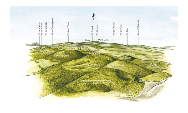
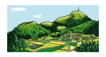
When there are too many trees the volcanic landforms are hard to see, and the volcanoes appear to be nothing more than wooded hills. The loss of visual identity through forestation is a particular threat in the extreme northern and southern parts of the Chaîne des Puys.
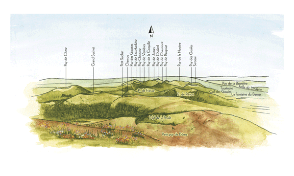
The aligned puys and surrounding wooded areas, view from the summit of the puy de Dôme in 2011 (R.Moutier)
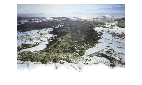
There is a marked difference between the lava flows and the surrounding plateau in terms of vegetation: trees grow on the less fertile lavas, while the plateau is covered in grass, which allows the lavas to be easily picked out in the landscape. However this delicate balance is threatened by the increasing trend away from agricultural land use.
It is vital that man continues to cultivate this land, and in particular maintains the grazing which is a major factor in keeping the landscape free of trees.
This has been incorporated into the management plan contained in the UNESCO application, in order to preserve the balance between farming and forestry which characterises the site.
Evolution of the landscape over time
The Chaîne des Puys-Limagne fault landscape has remained fundamentally very unaltered because there have been no changes to the geological or morphological aspects of the site.
However, superficially (in terms of woodland and agricultural plots) it has changed in a number of ways over the last 6,000 years.
Period 1 : Gallo-Roman era
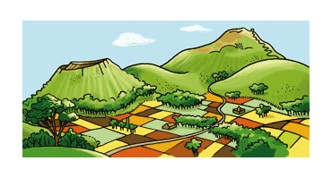
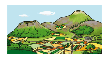
In Gallo-Roman times the whole of the Plateau des Dômes was under cultivation or in use for grazing, and the puys were only lightly wooded.
Period 2 : Renaissance period
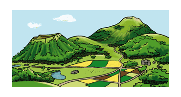
Following a difficult period during the 14th and 15th centuries, the inhabitants left the plateau, thereby massively reducing the amount of cultivated and inhabited land. This led to reforestation of the puys and lavas.
Agro-pastoralism did not return until the 16th century, followed by more intensive timber exploitation in the 17th century.
Period 3 : at the start of the 19th century
This period was marked by almost complete deforestation of the puys. Villages were established on the plateau, necessitating the conversion of grazing into arable land.
From 1827 the impoverished land was gradually reconverted into forest, and newly planted stands of trees appeared in the landscape.
Period 4 : present day
There are currently numerous wooded areas on the puys and their lava flows, but farming is still practised in the area, particularly in the central part of the Chaîne des Puys.

