The Limagne fault
Age
– 35 million years
What is it ?
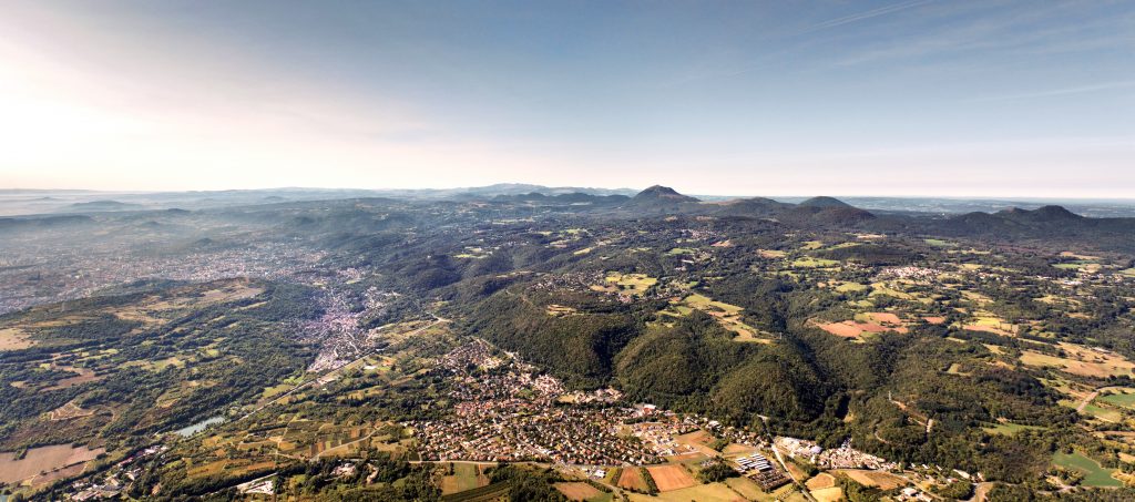
The Limagne Fault, one of the site’s major geological elements, formed as a fracture in the ancient continental basement around 35 Million years ago. Part of this continental basement subsided by around 3 km, and the resulting graben was infilled with sediments. The Limagne Plain, on which Clermont-Ferrand is now situated, lies in this downthrown graben. The Plateau des Dômes represents the original level of the ancient continental basement.
This phenomenon was related to the formation of the Alps: the continental crust was thinned parallel to the Alpine mountain chain, creating large-scale faults and subsidence (from the Massif Central to Bohemia in the Czech Republic), including the Limagne Fault. These faults are collectively known as the West European Rift. This stage marks the beginning of continental break-up.
If extension had continued, then the crust would have been progressively split in two, creating an ocean where the Limagne Plain now is.
Formation of the Limagne fault
Stage 1
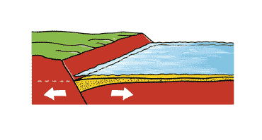
40 My ago, the crust became thinned and underwent extension, leading to the formation of the large western European grabens in which the ground level dropped by several kilometers. The Limagne graben floor dropped to around sea level, and was inundated by a shallow body of water. Over a period of several million years sediments were deposited which slowly infilled the graben.
Stage 2
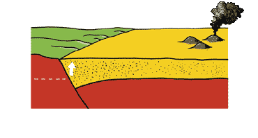
When the infill was completed, around 25 My, the sediments reached a depth of nearly 3,000 m, raising the level to that of the Plateau des Dômes. By this point the water had completely disappeared.
At the same time a forerunner of the Chaîne des Puys volcanism appeared in the sedimentary zone. Puy Crouel and Montrognon were active at this time.
Stage 3
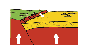
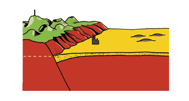
Somewhere around 3 – 1 My the basement and the sediments were uplifted together, triggering another intense, prolonged period of erosion which removed more than 500 m of sediments.
Stage 4
At the start of the Quaternary period (1 My) the fault was exposed by erosion, resulting in the current scarp relief. The sediments were not entirely eroded from the plain, and their remains give rise to the fertility of the wide Limagne Plain which covers the former graben.
Landscape attributes
The Limagne fault, which is defined as a ‘high quality forestry environment’, also serves to emphasis the Chaîne des Puys by acting as a natural geological pedestal.
The fault scarp has remained unspoilt due to the steepness of its slope, making it the home to a rich biodiversity. The appealing landscape, coupled with the proximity of the city, make this scarp an increasingly attractive place for walkers.
In addition, the fault relief forms a natural limit to encroaching urbanisation, which now abuts this geological boundary to the east.
Did you know ? The greatest depth of the Limagne fault is at Riom, where the sediments are 3,000 m thick.

